Applications: Examples of recent applications include: (i)Tanzania Cities Transforming Infrastructure & Competitiveness Project - (P171189) (ii) Kenya – The Kenya Informal Settlements Improvement Project (KISIP2) and Kenya Urban Services project (KUSP) (iii) The City Expansion Tracker presented for Kigali, which encompasses three cities of the 6-city pilot phase of the Ministry of Infrastructure’s Urban Dynamic Map, (iv) Morocco – Disaster Risk Financing
Data requirement: Global data (WSF tracker)
Final deliverables: A slide deck that provides the most up-to-date measure of urbanization status and rates of change, using satellite-based data to track building changes, updated every six months. It includes estimates of total buildings, new buildings in the last 12 months, and the fastest-growing cities, districts, or wards.
Indicative Cost / working time: $2-5k + any travel costs
Time Required for delivery: 1 month
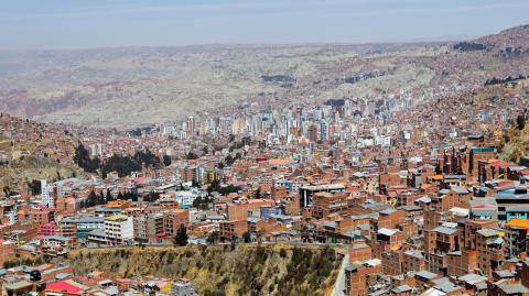
This is intended as the most up-to-date measure of urbanization status and rates of change for cities or portfolios of cities where urbanization is largely informal and local statistics vary in quality, consistency and timeliness.The tools uses the World Settlement Footprint Tracker (WSF Tracker) a 10m resolution satellite based measure of buildings change updated every six months (January 1st and July 1st each year); the team then provides local reference data (average building area by local admin unit) to estimate total buildings, new buildings in last 12 months, and fastest growing cities/districts/ward.