Applications: Cases/examples of the tool being used by task teams in operational work include: (i) Second Rwanda Urban Development Project – Urban Wetland Monitoring, (ii) Nigeria - West Africa Coastal Areas Management (WACA) Programme Multi-Sector Investment Plan (MSIP) – Hotspots Analysis, (iii) Cote D’Ivoire - Urban Resilience and Solid Waste Management Project – Informal Settlement Mapping and (iv) Jordan Sustainable Cities (ASA) – Green Area Potential.
Data requirement: Global data with option to incorporate local data
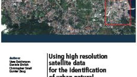
Final deliverables: A report that includes satellite data and analysis for urban wetland monitoring, flood mitigation, exposure hotspots, informal settlement mapping, and green area potential.
Geographic scope: City-level
Indicative Cost / working time: $200k
Time Required for delivery: 6 months
This is a collection of satellite services for urbanization projects within the bank. In total 21 data products are available covering four broader uses cases: (i) urban wetland monitoring for NBS and Flood mitigation, (ii) exposure hotspots analysis using interactive inputs for assets and hazards, (iii) Informal settlement mapping and (iv) green area potential.