Applications: Case studies developed in Kinshasa, DRC, and Kigali Rwanda
Data requirement: Global data + public transport datasets (to be purchased in addition)
Final deliverables: A slide deck (or report) that combines flood maps, public transport network feeds (GTFS data), and socio-economic data to assess changes in public transport functionality, loss of accessibility to jobs and services, and the most critical links in the transport network. It also attaches an economic cost to travel delays caused by floods.
Geographic scope: City-level
Hazards covered: Floods
Indicative Cost / working time: $15k - 25k, ~1 month
Methodology peer-reviewed, cleared (date)?: Yes, peer-reviewed methodology published in the journal Transportation Research part D in 2023
Time Required for delivery: 1 -2 months (depending on other commitments)
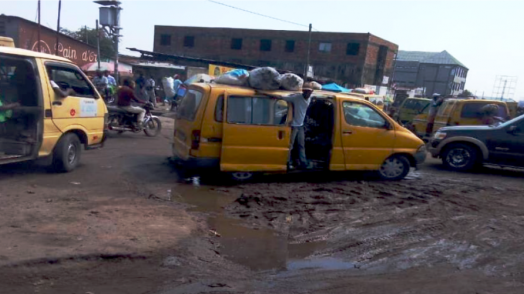
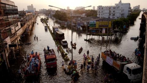
Combining and processing flood maps, public transport network feeds (GTFS data), and socio-economic data, this methodology can assess the change in functionality of the public transport services (including informal), the loss of accessibility to jobs and services, identify the most critical links in the public transport network and attach an economic cost to the travel delays caused by floods.