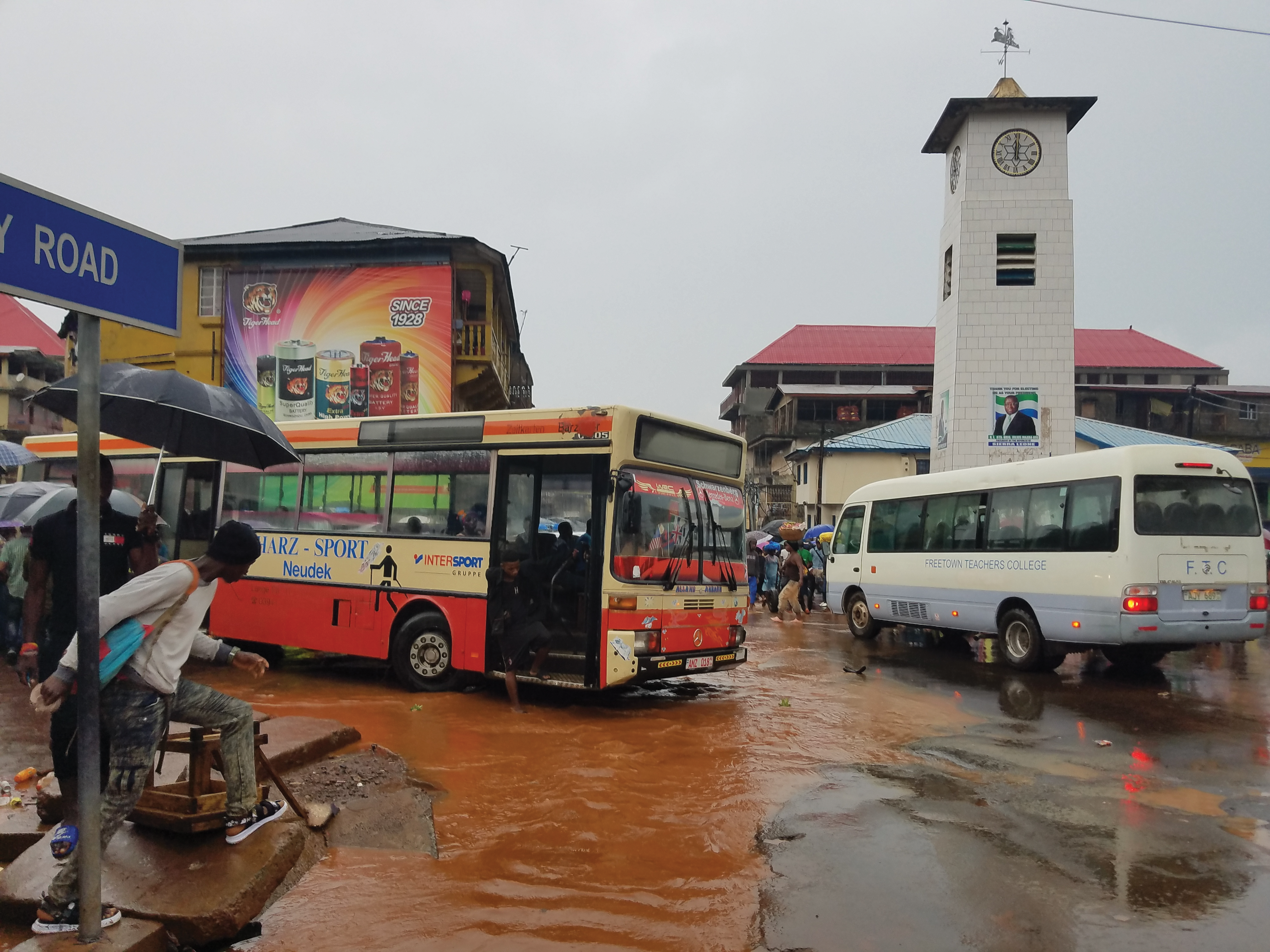
Freetown, Sierra Leone (Photo credit: World Bank)
Freetown is a vibrant city of 1 million inhabitants, contributing to 30 percent of Sierra Leone’s GDP, and located on a hilly peninsula surrounded by the Atlantic Ocean. It is one of the world’s most vulnerable cities to the impacts of climate change, with floods and landslides compromising its transport system, which is so important for its economic development. During the rainy season, the already inadequate transport services, badly maintained infrastructure, and chronic congestion are exacerbated by floods, which hinder access to jobs, universities, and overall mobility in the city. The public transport services in Freetown are growing rapidly—both formally and informally. Lack of data and a poor understanding of the vulnerabilities of the transport system to climate-related hazards is preventing city planners from improving and developing a sound and resilient transport system to meet the growing demand.
To address those challenges the government of Sierra Leone, with support from the Facility, worked to gain a better understanding of the roads’ vulnerability to floods and landslides and how climate change would affect the patterns and characteristics of those events. They collected data on public mobility on formal and informal transport systems and identified interventions to enhance the resilience of transport systems.
RESULTS IN NUMBERS
Overall, 64,000 people benefited from community-led resilience projects
Nearly 70 community-led resilience projects were supported 7 seismic and volcano monitoring stations were supported
To promote the use of innovative approaches for data collection, the World Bank transport team in Sierra Leone partnered with students from the Fourah Bay College, the engineering university in Freetown, and the WBG’s WhereIsMyTransport initiative. Mobile applications, such as the RoadLabPro, were used by local civil engineering students to map 4,038 km of formal and informal transportation systems. Flooded areas and the locations of critical road infrastructures, such as drainage and culverts, were also mapped. With this information, together with climate change projections for rainfall and sea level rise, researchers at the University of California Berkley developed risk maps for several scenarios and computed risk reduction for different road interventions.
A Resilient Urban Mobility Hackathon was also organized in collaboration with the Directorate of Science Technology and Innovation. More than 110 talented young people mentored by experts gathered for three days to produce innovative solutions for challenges related to resilient urban mobility. Winning solutions that will be developed include an app for cashless payment systems for public transport with adapted features for people with disabilities; a platform that reports on important information for flood mitigation; and a bus routing system with emergency response features.
This work resulted in the first comprehensive climate risk-informed transport map of Freetown and will support decision making on everything from infrastructure and policies to journey planning. It has already informed the $50 million Integrated and Resilient Urban Mobility Project funded by IDA that will address identified challenges. Because the transport map is also publicly available, several developers across West Africa are building apps to support decision making and journey planning.
"I see we are going in the right direction. We need to use more data for decision making. And we need more people locally that can collect and analyze the data to make the decisions."
—Professor Obafemi Davies, Head of Civil Engineering Department, Fourah Bay College
